


Classic Trekking Circuit in the Cordillera Blanca
An unforgettable journey through turquoise lakes, lush valleys, and iconic Andean peaks.
One of the Top 10 Treks in the World, this is the most classic route in Peru’s Cordillera Blanca — a true Andean adventure from start to finish.
Recognized worldwide among the Top 10 Treks on Earth, the Santa Cruz Trek represents the essence of the Cordillera Blanca.
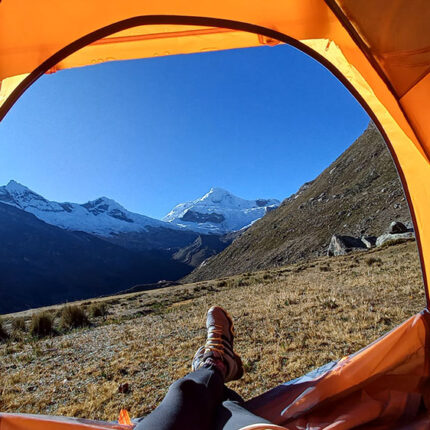
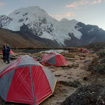
Over four days, you’ll explore dramatic high-altitude valleys, cross the famous Punta Unión Pass (4,750 m / 15,584 ft), and camp beside turquoise Andean lakes framed by snow-capped peaks.
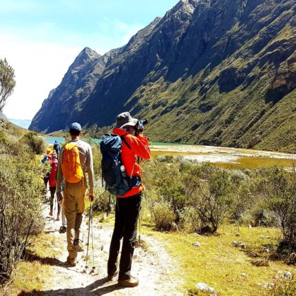
This route connects Vaquería to Cashapampa, traversing the heart of Huascarán National Park — ideal for those seeking a short but spectacular multi-day trek with Inkaland Treks’ professional support.
Quick Facts Santa Cruz Classic Trek via Vaquería
- Location: Cordillera Blanca, Peru
- Duration: 4 days / 3 nights
- Distance: ~50 km / 31 mi total
- Max Elevation: 4,750 m / 15,584 ft (Punta Unión Pass)
- Min Elevation: 2,900 m / 9,514 ft (Cashapampa)
- Difficulty: Moderate
- Best Season: May – September (dry season)
- Start / End: Vaquería → Cashapampa
- Group Size: Small groups (max 8) or private treks
👉 Perfect for hikers in good physical condition with 2–3 days of prior acclimatization.
Highlights Santa Cruz Classic Trek via Vaquería
- Cross Punta Unión Pass (4,750 m / 15,584 ft) — one of the most iconic viewpoints in the Andes
- Visit turquoise lakes: Ichiccocha, Jatuncocha, and Arhuaycocha
- See Alpamayo, “the most beautiful mountain in the world”
- Traverse from Vaquería to Cashapampa through glacial valleys and lush canyons
- Led by experienced English-speaking guides & full Inkaland Treks logistics
Itinerary at a Glance
| Day | Route | Distance | Max Elevation | Hiking Time | Highlights |
| 1 | Huaraz → Vaquería → Paria Camp | 10–12 km / 6.2–7.4 mi | 3,800 m / 12,467 ft | 5–6 h | Scenic drive, start of trek |
| 2 | Paria → Punta Unión Pass → Taullipampa | 11–13 km / 6.8–8.1 mi | 4,750 m / 15,584 ft | 7–8 h | Cross Punta Unión Pass |
| 3 | Taullipampa → Arhuaycocha (optional) → Llamacorral | 13–15 km / 8.1–9.3 mi | 4,450 m / 14,600 ft | 6–7 h | Alpamayo viewpoint & lakes |
| 4 | Llamacorral → Cashapampa → Huaraz | 12–13 km / 7.4–8.1 mi + drive | 2,900 m / 9,514 ft | 4–5 h + 3 h drive | Final descent & return to Huaraz |
Distances & times are approximate and may vary depending on pace and weather.
 5+ spots
 Confirmed
 4 spots